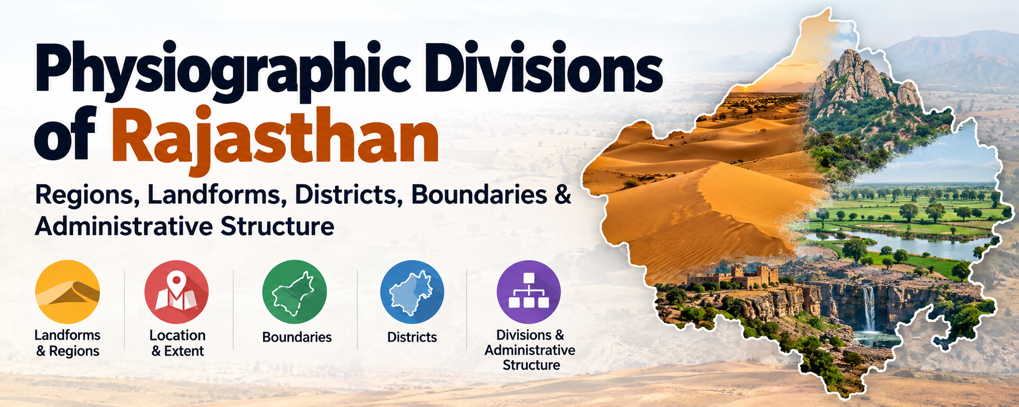
Physiographic Divisions of Rajasthan: Regions, Landforms, Districts, Boundaries & Administrative Structure
In this article12
- Introduction
- Location, extent and boundaries
- Districts and divisions
- At a glance
- 1. Western Sandy Plains (The Thar Region)
- 2. Aravalli Range and Hilly Region
- 3. The Eastern Plains
- 4. South-eastern Rajasthan Plateau (Hadoti)
- Quick comparison
- How the landscape shapes life in Rajasthan
- Conclusion
- Practice questions
Dunes in the west, the Aravalli ridge through the middle, river plains in the east and a black-soil plateau in the south-east: how Rajasthan’s land is laid out, and why its climate, crops and minerals follow that layout.
Introduction
Rajasthan is India’s largest state by area, and it is also the one with the widest physical contrast. Within a few hundred kilometres you move from rolling sand dunes in Jaisalmer to the cool, forested heights of Mount Abu, then down into the wheat-and-mustard plains of the east, and finally onto the volcanic black-soil plateau around Kota.
This variety is not an accident. It is the result of very old geology (the Aravalli is among the oldest fold mountains on Earth), a strong rainfall gradient from west to east, and the work of rivers and wind over millions of years. Understanding physiography (relief, rock, drainage and slope taken together) is the key to understanding why the state’s climate, soils, crops, minerals and settlements are distributed the way they are.
Geographers divide the state into four physiographic divisions: the Western Sandy Plains, the Aravalli Range and Hilly Region, the Eastern Plains and the South-eastern Plateau (Hadoti).
Location, extent and boundaries
Rajasthan lies in the north-western part of India, in the Northern Hemisphere by latitude and the Eastern Hemisphere by longitude. It covers 3,42,239 sq km, which was 10.41% of India’s area when the present boundaries were fixed on 1 November 1956. T. H. Handley described its shape as a rhombus (kite-shaped).
Extent
| South to north (latitude) | West to east (longitude) | |
|---|---|---|
| Limits | 23°03′ N (Borkund, Banswara) to 30°12′ N (Kona village, Sri Ganganagar) | 69°30′ E (Katra village, Jaisalmer) to 78°17′ E (Silan village, Dholpur) |
| Span | 7°9′ | 8°47′ |
| Maximum distance | 826 km (length) | 869 km (width) |
- The width exceeds the length by 43 km.
- The Tropic of Cancer (23°30′ N) passes through the southern tip of the state near Banswara, including parts of Dungarpur.
- The local time of Dholpur (east) is ahead of Jaisalmer (west) by 35 minutes 8 seconds.
- Satellite surveys place the geographical centre of the state at Gagrana village (Nagaur).
The border with Pakistan (Radcliffe Line)
Rajasthan has a total land boundary of 5,920 km: 1,070 km international and 4,850 km interstate.
- The Rajasthan–Pakistan border is part of the Radcliffe Line, which is 3,310 km long in all and also touches Punjab, Gujarat, Jammu and Kashmir and Ladakh.
- It starts at Hindumalkot (Sri Ganganagar) and ends at Shahgarh or Bakhasar (Barmer).
- Five districts lie on it. From north to south they are Sri Ganganagar, Bikaner (168 km), Phalodi, Jaisalmer (464 km) and Barmer.
- On the Pakistan side the border faces Bahawalnagar, Bahawalpur and Rahim Yar Khan (Punjab province), and Ghotki, Sukkur, Khairpur, Sanghar, Umarkot and Tharparkar (Sindh province).

Download High Quality pdf of the updated map of Rajasthan by clicking here.
| Fact | District |
|---|---|
| Longest international border | Jaisalmer |
| Shortest international border | Phalodi |
| District headquarters closest to the border | Sri Ganganagar |
| District headquarters farthest from the border | Bikaner |
| Districts with both international and interstate borders | Sri Ganganagar and Barmer |
Borders with other states
| State | Shared boundary | Bordering districts of Rajasthan |
|---|---|---|
| Madhya Pradesh | 1,600 km | Dholpur, Karauli, Sawai Madhopur, Kota, Baran, Jhalawar, Chittorgarh, Bhilwara, Pratapgarh, Banswara |
| Haryana | 1,262 km | Hanumangarh, Churu, Jhunjhunu, Sikar, Kotputli-Behror, Khairthal-Tijara, Alwar, Deeg |
| Gujarat | 1,022 km | Banswara, Dungarpur, Udaipur, Sirohi, Jalore, Barmer |
| Uttar Pradesh | 877 km | Deeg, Bharatpur, Dholpur |
| Punjab | 89 km | Sri Ganganagar, Hanumangarh |
| Total | 4,850 km |
Points to remember
- Four districts border two states: Hanumangarh (Punjab and Haryana), Deeg (Haryana and Uttar Pradesh), Dholpur (Uttar Pradesh and Madhya Pradesh) and Banswara (Madhya Pradesh and Gujarat).
- Jhalawar has the longest interstate border (520 km). Barmer has the shortest (14 km).
- 28 districts have a border of some kind: 25 share an interstate border, 23 of them only an interstate border, and three (Jaisalmer, Bikaner, Phalodi) only the international border.
- 13 districts are inland, with no border at all: Jaipur, Dausa, Tonk, Bundi, Ajmer, Beawar, Didwana-Kuchaman, Nagaur, Jodhpur, Balotra, Pali, Rajsamand and Salumber.
- Kota and Chittorgarh touch the Madhya Pradesh border twice. In Chittorgarh the two stretches are cut apart by Bhilwara, so the district is fragmented. Kota’s is continuous.
Districts and divisions
Rajasthan has 41 districts grouped into 7 divisions.
| Division | Districts | Count |
|---|---|---|
| Jaipur | Jaipur, Kotputli-Behror, Dausa, Alwar, Khairthal-Tijara, Sikar, Jhunjhunu | 7 |
| Bharatpur | Bharatpur, Deeg, Dholpur, Karauli, Sawai Madhopur | 5 |
| Ajmer | Ajmer, Tonk, Beawar, Nagaur, Didwana-Kuchaman, Bhilwara | 6 |
| Kota | Kota, Baran, Bundi, Jhalawar | 4 |
| Udaipur | Udaipur, Chittorgarh, Salumber, Rajsamand, Banswara, Dungarpur, Pratapgarh | 7 |
| Jodhpur | Jodhpur, Phalodi, Jaisalmer, Barmer, Balotra, Pali, Jalore, Sirohi | 8 |
| Bikaner | Bikaner, Sri Ganganagar, Hanumangarh, Churu | 4 |
- Jodhpur is the largest division by area and has the most districts (8).
- Kota is the smallest division and has the fewest districts (4, tied with Bikaner on the count).
- By area (older figures, before the recent changes), the largest districts are Jaisalmer, Bikaner, Barmer and Jodhpur, and the smallest are Dholpur, Dausa, Dungarpur and Pratapgarh.
How the number of districts grew
| Date | District | Number | Carved from |
|---|---|---|---|
| 15 April 1982 | Dholpur | 27th | Bharatpur |
| 10 April 1991 | Baran | 28th | Kota |
| 10 April 1991 | Dausa | 29th | Jaipur |
| 10 April 1991 | Rajsamand | 30th | Udaipur |
| 12 July 1994 | Hanumangarh | 31st | Sri Ganganagar |
| 19 July 1997 | Karauli | 32nd | Sawai Madhopur |
| 26 January 2008 | Pratapgarh | 33rd | Chittorgarh, Udaipur and Banswara |
| 7 August 2023 | Eight new districts (34th to 41st), listed below |
The 2023 expansion and the 2024 rollback
In 2023 the state government carried out its biggest reorganisation. It created 17 new districts and three new divisions (Pali, Sikar and Banswara), which took the count to 50 districts and 10 divisions. On 28 December 2024 the cabinet reversed much of this. It scrapped nine of the new districts (Anupgarh, Dudu, Gangapur City, Jaipur Rural, Jodhpur Rural, Kekri, Neem Ka Thana, Sanchore and Shahpura), the three new divisions, and three more districts announced in October 2023 (Malpura, Sujangarh and Kuchaman). That brought the state back to 41 districts and 7 divisions.
The eight districts that were kept, all formed on 7 August 2023, are:
| New district | Carved from | Division |
|---|---|---|
| Deeg | Bharatpur | Bharatpur |
| Kotputli-Behror | Alwar and Jaipur | Jaipur |
| Khairthal-Tijara | Alwar (mainly) | Jaipur |
| Salumber | Udaipur | Udaipur |
| Beawar | Ajmer, Pali, Rajsamand and Bhilwara | Ajmer |
| Didwana-Kuchaman | Nagaur | Ajmer |
| Phalodi | Jodhpur | Jodhpur |
| Balotra | Barmer | Jodhpur |
At a glance
| Division | Share of area | Share of population | Character |
|---|---|---|---|
| Western Sandy Plains | ~61% | ~40% | Arid to semi-arid; dunes, salt lakes, inland drainage |
| Aravalli Range & Hilly Region | ~9% | ~10% | Old fold mountains; climatic and drainage divide |
| Eastern Plains | ~23% | ~39% | Alluvial plains; most fertile and densely settled |
| South-eastern Plateau (Hadoti) | ~7% | ~11% | Deccan lava, black soil, Chambal drainage |
The big picture: the Aravalli runs diagonally from south-west to north-east and splits the state. Roughly three-fifths of the land lies to its west (dry) and two-fifths to its east (wetter and more fertile). Travelling east to west, the order of divisions is: Hadoti Plateau, Eastern Plains, Aravalli Range, Western Sandy Plains.
1. Western Sandy Plains (The Thar Region)
This is the largest division, covering the districts of Hanumangarh, Sri Ganganagar, Bikaner, Jaisalmer, Barmer, Jalore, Sirohi, Pali, Jodhpur, Nagaur, Churu, Sikar and Jhunjhunu. Annual rainfall is low, generally under 50 cm, and falls as you go west.
Its eastern boundary follows the western foothills of the Aravalli.
The most useful way to divide this region is by rainfall. The 25 cm isohyet is the dividing line:
- West of it: the Sandy Arid Plain (the true desert)
- East of it: the Semi-Arid Basin, also called the Rajasthan Bangar
The drainage of this entire region is mostly inland. Streams rarely reach the sea; they spread out, sink into the sand or end in salty depressions. The one major river that carries its water out of the region is the Luni, which ends in the Rann of Kachchh in Gujarat.
1A. Sandy Arid Plain
The core of the desert. It lies mainly in Jaisalmer and Bikaner, with parts of Churu, Nagaur, Jodhpur and Barmer. Rainfall is the lowest in the state (around 30 cm at best, much less in Jaisalmer), summers are brutally hot and the soil is sandy and loose. Here and there, rocky outcrops of granite, limestone and sandstone poke through the sand, and shallow depressions with salty water (playas, called rann or dhand locally) collect after rain.
It has two sub-regions.
Marusthali (the dune desert)
Marusthali covers Bikaner, Jaisalmer, Churu, western Nagaur and the western parts of Jodhpur and Barmer. This is the “classic” Thar: wave after wave of dunes, many of them in constant motion. Shifting sand dunes are locally called dhariyan.
Wind, not water, is the main shaping force. Dunes here range from roughly 6 m to 60 m in height and can stretch 3 to 5 km in length. They come in different forms depending on wind pattern and sand supply:
| Dune type | How it forms | Notes |
|---|---|---|
| Longitudinal | Long ridges parallel to the prevailing wind | Can run for several kilometres |
| Barchan (crescent) | Horns point downwind; steep leeward face | Most mobile; a serious threat to farmland and roads |
| Transverse | Built across the wind direction | Gentle windward slope, steep leeward slope |
| Parabolic | U-shaped, often anchored by vegetation | Form where plants partly hold the sand |
| Star | Winds from several directions pile sand into a peak | Less common |
Barchans move, and a moving dune buries fields, canals, railway lines and villages. Shelterbelts, grass cover and the Indira Gandhi Canal’s plantation programme are all attempts to fix the dunes in place.
Dune-free Tract
Between Ramgarh and Pokhran, in the shape of a rough inverted triangle, lies a rocky, relatively flat belt with no dunes. It is largely in Jaisalmer and partly in Jodhpur. The exposed rock is limestone and sandstone of Jurassic and Eocene age, which is why the region has fossil wealth: the Akal Wood Fossil Park near Jaisalmer preserves tree trunks that are millions of years old. Dry riverbeds and their banks are the easiest places to tap groundwater here.
1B. Semi-Arid Basin (Rajasthan Bangar)
East of the 25 cm isohyet, rainfall rises (25 to 50 cm), dunes become lower and more fixed, and the land is far more usable for agriculture. This belt acts as a transition zone between the true desert and the Aravalli. It has four sub-regions.
Ghaggar Plain
In the extreme north, in Hanumangarh and Sri Ganganagar. This is the flood plain of the ancient Ghaggar (the seasonal river that survives as the Ghaggar-Hakra channel; its dry bed is locally called Nali). The plain has alluvium and black clay and is dotted with low dunes (around 6 to 30 m) and small sand hills. Thanks to the Gang Canal and the Indira Gandhi Canal, this is now one of Rajasthan’s most productive agricultural tracts: wheat, cotton, mustard, rice, sugarcane, vegetables and citrus.
Shekhawati Region
Covers Churu, Sikar and Jhunjhunu (with parts of Nagaur). It is a plain of inland drainage, with undulating sandy terrain, transverse dunes and a number of saline lakes and playas. The only notable seasonal stream is the Kantli. The northern spurs of the Aravalli (Khetri, Raghunathgarh, Torawati hills) poke through here, which is also why Khetri is a copper centre. Livestock rearing and dairying are important to the local economy.
Nagaur Upland
Mostly in Nagaur district, at an elevation of roughly 300 to 500 m, receiving about 25 cm of rain in the west to 50 cm in the east. The landscape is a mix of sand hills and low depressions. Because summer temperatures are high, the salty flood water collecting in these depressions evaporates and leaves behind salt and soda deposits; the infertile salty soil is known locally as reh. Salt lakes like Didwana, Kuchaman and Degana belong to this belt.
Luni Basin (Godwar and Sanchor)
The Luni is the key river of the desert. It rises in the Aravalli near Ajmer (Nag Hills), flows south-west through Pali, Jodhpur, Barmer and Jalore, and ends in the Rann of Kachchh. It is seasonal, floods during heavy rain, and its water turns increasingly saline downstream. Its main tributaries include the Sukri, Jojari, Bandi, Sagi and Jawai.
The basin is traditionally divided into:
- Godwar: the Luni-Jawai region, mainly in Pali and parts of Jodhpur, Jalore and Sirohi
- Sanchor tract: mainly in Jalore, noted for its comparatively fertile soil
The basin’s topography combines steep-sided hills with wide alluvial plains. The better alluvial stretches are locally known as Naid (Rel).
2. Aravalli Range and Hilly Region
If Rajasthan has a physical backbone, this is it. The Aravalli is a Precambrian fold mountain system, among the oldest in the world. It was once far taller, perhaps comparable to much younger ranges, but hundreds of millions of years of weathering and erosion have worn it down into the ridges and rounded hills we see today.
Key facts
- The range runs from Gujarat in the south-west to the Raisina Hills (Delhi) in the north-east.
- Total length is about 692 km, of which roughly 550 km lies in Rajasthan, from Sirohi (Abu) in the south-west to Khetri (Jhunjhunu) in the north-east.
- It crosses Gujarat, Rajasthan, Haryana and Delhi.
- Its south-eastern edge, towards the Vindhyan plateau, is marked by the Great Boundary Fault.
- The range is highest and most continuous in the south (Sirohi, Udaipur) and gets lower, broken and discontinuous towards the north-east.
Why the Aravalli matters
- It is a watershed. Rivers flowing east (Banas, Berach and others, joining the Chambal and Yamuna) head to the Bay of Bengal system, while those flowing west (Luni, West Banas, Sabarmati) head toward the Arabian Sea system.
- It shapes the climate. It lies parallel to the south-west monsoon winds, so it does not stop them much. This is one reason the west stays dry; the higher southern parts near Mount Abu receive the heaviest rainfall in the state.
- It holds back the desert. Gaps in the range, and illegal mining, let sand drift eastward. Continuous ranges and forest cover act as a barrier.
- It is a mineral store. Copper (Khetri), zinc and lead (Zawar, Rajpura-Dariba), marble (Makrana, Rajsamand) and granite all come from here.
Two ways of dividing the Aravalli
Within Rajasthan, the usual division, based on altitude and form, is into four sections:
| Section | Extent | Districts (main) | Highest point |
|---|---|---|---|
| North-eastern Aravalli (Alwar Hills) | Delhi ridge to the hills of Alwar and Jaipur | Alwar, Jaipur, Sikar, Jhunjhunu, Sawai Madhopur | Raghunathgarh, Sikar (1,055 m) |
| Central Aravalli | Sambhar Lake to the Bhorat plateau | Ajmer, Tonk, Jaipur | Goramji, Ajmer (~934 m); Taragarh (870 m) |
| Mewar Rocky Region & Bhorat Plateau | Southern Aravalli | Udaipur, Pali, Dungarpur | Jarga (1,431 m) |
| Abu Block | Isolated block, separated from the main range by the West Banas valley | Sirohi | Guru Shikhar (1,722 m) |
2A. North-eastern Aravalli (Alwar Hills)
Starts from the Delhi ridge and stretches to the isolated hills of Alwar and Jaipur. Heights average between about 300 and 670 m. The valleys between ridges are wide, and some hilltops are flat enough to form small plateaus. The hills include the Malkhet and Khetri groups and the Torawati hills, and there are lakes such as Sambhar, Ramgarh and Pandupole in or near this belt. Towards the north and east, the hills dissolve into the Ganga-Yamuna plains.
2B. Central Aravalli
Roughly 100 km long and 30 km wide, and not continuous. It is made up of broken ridges and valleys cut by streams (valley depth up to ~550 m in places). It extends from the Sambhar basin to the Bhorat plateau and is bordered by the Alwar hills in the north, the Banas plains in the south, the Sambhar basin to the west, and the Karauli tableland to the east.
2C. Mewar Rocky Region and Bhorat Plateau
The highest and most rugged part of the main range, covering Udaipur, Rajsamand, Pali and Dungarpur. The Bhorat Plateau lies between the forts of Kumbhalgarh and Gogunda, at about 1,225 m, making it one of the highest tablelands in the Aravalli. Apart from Abu, this is the highest part of the whole range.
2D. Abu Block
An isolated granite block in Sirohi, cut off from the main range by the wide valley of the West Banas. It carries the state’s highest point, Guru Shikhar (1,722 m), and the Abu plateau (about 1,200 m) with the town of Mount Abu and Achalgarh fort. Mount Abu records the highest rainfall in Rajasthan, which is why it has dense forest and is a wildlife sanctuary.
Highest peaks of the Aravalli in Rajasthan
| # | Peak | Height (m) | District |
|---|---|---|---|
| 1 | Guru Shikhar | 1,722 | Sirohi (Mount Abu) |
| 2 | Ser | ~1,597 | Sirohi |
| 3 | Delwara | 1,442 | Sirohi |
| 4 | Jarga | 1,431 | Udaipur |
| 5 | Achalgarh | 1,380 | Sirohi |
| 6 | Kumbhalgarh | 1,224 | Rajsamand |
| 7 | Raghunathgarh | 1,055 | Sikar |
| 8 | Kamalnath | 1,001 | Udaipur |
| 9 | Khoh | 920 | Jaipur |
| 10 | Taragarh | 870 | Ajmer |
| 11 | Bhairach | 792 | Alwar |
| 12 | Babai | 780 | Jhunjhunu |
| 13 | Bairath | 704 | Jaipur |
Plateaus of the Aravalli region
| Plateau | Location | Notes |
|---|---|---|
| Uriya | Sirohi | Highest plateau in Rajasthan (~1,360 m) |
| Bhorat | Between Kumbhalgarh (Rajsamand) and Gogunda (Udaipur) | ~1,225 m; second highest plateau; also acts as a water divider |
| Abu | Sirohi | ~1,200 m; Mount Abu and Guru Shikhar |
| Bhomat | Between Udaipur and Dungarpur | Hilly plateau region; Bhil tribe lives mostly here |
| Lasadia | East of Jaisamand Lake, Udaipur | Dissected plateau in the southern Aravalli |
| Mesa | Chittorgarh | Not part of the Aravalli; Chittorgarh Fort stands on it |
Important passes (called nal or ghat locally)
Passes across the Aravalli are locally called nal or ghat. Most of them lie in Rajsamand district.
| Pass | District | Notes |
|---|---|---|
| Jilwa / Pagalya | Rajsamand | Links the Desuri (Pali) side with Charbhuja (Rajsamand) |
| Hathi Gudha | Rajsamand | |
| Kamli Ghat | Rajsamand | |
| Goram Ghat | Rajsamand | |
| Someshwar | Rajsamand | |
| Desuri | Pali | On the Pali to Charbhuja (Rajsamand) route |
| Bar | Pali | Connects Bar (Pali) with Beawar (Ajmer) |
3. The Eastern Plains
East of the Aravalli, the land drops into broad, gently sloping plains built up by rivers over geological time. This division makes up about 23% of the state’s area but holds close to 39% of its population, and it is the agricultural and urban heartland of Rajasthan. It spreads over districts like Jaipur, Alwar, Bharatpur, Dholpur, Karauli, Sawai Madhopur, Tonk, Bhilwara, Chittorgarh, Bundi, Kota and the southern districts of Dungarpur, Banswara and Pratapgarh.
Rainfall is higher than in the west, soils are alluvial and drainage is well developed. It is divided into three sub-regions according to river basins.
| Sub-region | Main districts |
|---|---|
| Chambal basin | Kota, Bundi, Baran, Tonk, Sawai Madhopur, Dholpur |
| Banas basin | Udaipur, Chittorgarh, Bhilwara, Tonk, Jaipur, Alwar, Sawai Madhopur |
| Mahi (Chhappan) basin | Dungarpur, with Banswara and Pratapgarh in the south |
3A. Chambal Basin
The area drained by the Chambal river, covering Kota, Sawai Madhopur, Karauli and Dholpur. Its signature feature is badland topography: deep gullies and ravines carved into soft alluvium, the famous ravines (beehads) of the Chambal. Before reaching the Yamuna, the river creates gorges, waterfalls, steep banks and cliffs. In the southern part of the basin there are irregular hill tracts known as Dangs.
3B. Banas Basin
A broad plain formed by the Banas and its tributaries (Berach, Menal, Kothari, Khari, Mansi, Bandi and others), sloping from west to east. It is an elevated plain whose surface represents an old erosion surface, called a peneplain. It is split into two parts:
- Mewar Plain (south): a dissected plain of Archean granite and gneiss with elevation around 280 to 500 m, sloping to the east and north-east
- Malpura-Karauli Plain (north): a flat upland of schist and gneiss, elevation roughly 250 to 350 m, described by the geographer Heron as a Tertiary peneplain; thick alluvial deposits occur around Malpura and Kishangarh
3C. Mahi (Chhappan) Basin
Located in the extreme south, in Dungarpur, Banswara and Pratapgarh, to the south of the Banas plain and east of the Mewar hills. The Mahi rises in Madhya Pradesh and ends in the Gulf of Khambhat. The western section is hilly, but the central and eastern parts are fertile and heavily cultivated; the area between Banswara and Pratapgarh is called the Chhappan Plain. The deeply dissected plains and hill tracts of the region are collectively known as Bagar (Vagad). Elevation is around 200 to 400 m.
4. South-eastern Rajasthan Plateau (Hadoti)
In the south-east lies a plateau that geologically belongs to the Malwa Plateau. It is called Hadoti (after the Hada Rajputs who ruled Kota and Bundi) and is also called Pathar or Uparmal (high, stony plateau). It covers Kota, Bundi, Baran and Jhalawar, with parts of Bhilwara, and about 7% of the state’s area. The Great Boundary Fault forms its north-western edge, and the Chambal and its tributaries (Kali Sindh, Parwan, Parvati) drain most of it.
The region rests on Deccan Trap lava in its southern parts, which weathered into black cotton soil (regur), ideal for cotton, soybean, oranges (Jhalawar), coriander and wheat. Rainfall is good, rivers are plentiful, and irrigation (Chambal Project, with Gandhi Sagar, Rana Pratap Sagar and Jawahar Sagar dams) has made it one of Rajasthan’s most productive zones.
It has two sub-regions.
4A. Deccan Highlands (Lava Plateau)
Found in Bundi, Kota and Jhalawar. The ground rises in a set of steps and ridges, and the western sections of the Vindhyan plateau appear as three concentric escarpments of sandstone with shale/slate in between. Important landforms include:
- Bundi Hills: two roughly parallel crescent-shaped ranges
- Mukundara Hills: across Kota and Jhalawar; home to the Mukundra Hills Tiger Reserve
- Ramgarh-Shahabad and Dag-Gangadhar uplands: upland tracts in Baran and Jhalawar
4B. Vindhyan Region
Found in Karauli, Sawai Madhopur, Dholpur, Bundi and Kota. The terrain is hilly and uneven, strewn with boulders and ravines. Steep scarps face south-south-east, between the Banas and the Chambal, and continue eastward into Bundelkhand. The ridges are made of massive Vindhyan sandstone, which is quarried widely (for example the red sandstone of Dholpur and the stone of Kota). Heights average around 350 to 550 m.
Quick comparison
| Feature | Western Sandy Plains | Aravalli | Eastern Plains | Hadoti Plateau |
|---|---|---|---|---|
| Rainfall | Lowest (<50 cm, falling westward) | Varies; Abu highest | Moderate (higher than the west) | High (humid) |
| Relief | Dunes, rocky tracts, salt lakes | Ridges, plateaus, passes | Gently sloping plains | Plateau, escarpments |
| Rock / soil | Sandy, saline soils | Quartzite, marble, granite | Alluvium | Deccan lava, black soil |
| Drainage | Mostly inland; Luni | Source of many rivers; watershed | Banas, Chambal, Mahi | Chambal and tributaries |
| Economy | Livestock, canal farming, gypsum, limestone | Minerals, forests, tourism | Intensive agriculture, cities | Cotton, soybean, citrus, stone |
How the landscape shapes life in Rajasthan
- Climate: the Aravalli, together with the rainfall gradient, explains why western Rajasthan is hot desert while the east is semi-humid.
- Water: the west depends on canals (Indira Gandhi Canal), groundwater and traditional systems, while the east and south-east draw on rivers and large dams.
- Agriculture: bajra, moth and guar in the west; wheat, mustard and barley in the east; cotton, soybean and oranges in Hadoti.
- Minerals: the Aravalli is the mineral belt (zinc, lead, copper, marble, granite), while the desert holds limestone, gypsum and fossil fuel potential.
- History and culture: hill forts, passes and plateaus shaped the geography of Marwar, Mewar and Hadoti, as well as peasant and tribal movements.
Conclusion
Rajasthan’s four physiographic divisions each tell a different story. The Western Sandy Plains show what wind and aridity can do. The Aravalli records hundreds of millions of years of earth history and still decides where the rain falls and which way the rivers run. The Eastern Plains show what rivers can build, and the Hadoti Plateau carries the mark of ancient volcanic activity. Together they explain the state’s rainfall, rivers, soils, crops, minerals and settlements, and the pressure points that remain: moving dunes in the west, mining in the Aravalli and ravine erosion along the Chambal.
Practice questions
Q1. Consider the following statements about the drainage of western Rajasthan.
- Drainage in the Western Sandy Plains is mostly inland, with streams ending in sand or salty depressions.
- The Luni rises in the Aravalli near Ajmer and ends in the Rann of Kachchh.
- The water of the Luni becomes less saline as it flows downstream.
Which of the statements given above are correct?
- (a) 1 and 2 only
- (b) 2 and 3 only
- (c) 1 and 3 only
- (d) 1, 2 and 3
Answer: (a). The Luni’s water turns increasingly saline downstream.
Q2. Assertion (A): Western Rajasthan stays dry even though the Aravalli range runs through the state.
Reason (R): The Aravalli lies parallel to the south-west monsoon winds, so it does little to stop them.
- (a) Both A and R are true, and R is the correct explanation of A
- (b) Both A and R are true, but R is not the correct explanation of A
- (c) A is true, but R is false
- (d) A is false, but R is true
Answer: (a)
Q3. Consider the following statements about sand dunes in Marusthali.
- Barchans are crescent-shaped dunes whose horns point downwind.
- Barchans are the most mobile dunes and a serious threat to farmland, roads and railway lines.
- Longitudinal dunes are built across the direction of the prevailing wind.
Which of the statements given above are correct?
- (a) 1 only
- (b) 1 and 2 only
- (c) 2 and 3 only
- (d) 1, 2 and 3
Answer: (b). Longitudinal dunes lie parallel to the wind. Transverse dunes are the ones built across it.
Q4. Match the sub-region with its characteristic feature.
| Sub-region | Feature |
|---|---|
| A. Ghaggar Plain | 1. Salt lakes and saline reh soil |
| B. Nagaur Upland | 2. Canal-irrigated wheat, cotton and mustard |
| C. Luni Basin | 3. Godwar and Sanchor tracts |
| D. Chambal Basin | 4. Badland ravines |
- (a) A-2, B-1, C-3, D-4
- (b) A-1, B-2, C-4, D-3
- (c) A-2, B-3, C-1, D-4
- (d) A-4, B-1, C-3, D-2
Answer: (a)
Q5. Consider the following statements about the Aravalli range.
- The highest peak in Rajasthan, Guru Shikhar, lies on the Abu Block, which is separated from the main range by the West Banas valley.
- The range acts as a watershed between rivers that flow east and rivers that flow west.
- The range is highest and most continuous in the north-east.
Which of the statements given above are correct?
- (a) 1 only
- (b) 1 and 2 only
- (c) 2 and 3 only
- (d) 1, 2 and 3
Answer: (b). The range is highest and most continuous in the south, and becomes lower and broken towards the north-east.
Q6. Consider the following statements about the Hadoti Plateau.
- The Great Boundary Fault forms its north-western edge.
- Deccan Trap lava in its southern parts has weathered into black cotton soil.
- It is drained mainly by the Luni and its tributaries.
Which of the statements given above are correct?
- (a) 1 only
- (b) 1 and 2 only
- (c) 2 and 3 only
- (d) 1, 2 and 3
Answer: (b). The Chambal and its tributaries drain Hadoti.
Q7. The Eastern Plains hold about two-fifths of Rajasthan’s population on less than a quarter of its area. Which of the following best explains this?
- (a) Rich mineral deposits and a continuous mountain barrier
- (b) Alluvial soils, higher rainfall and well-developed drainage
- (c) Dune-free rocky terrain and inland drainage
- (d) Deccan lava soils and the absence of rivers
Answer: (b)
Q8. Consider the following statements about the boundaries of Rajasthan.
- The Rajasthan–Pakistan border runs from Hindumalkot (Sri Ganganagar) to Shahgarh or Bakhasar (Barmer).
- Jaisalmer has the longest stretch of international border among the border districts.
- Rajasthan shares its longest interstate boundary with Gujarat.
Which of the statements given above are correct?
- (a) 1 and 2 only
- (b) 2 and 3 only
- (c) 1 and 3 only
- (d) 1, 2 and 3
Answer: (a). Madhya Pradesh, at 1,600 km, is the longest interstate boundary.
Q9. Match the district with its number in the order of formation.
| District | Number |
|---|---|
| A. Dholpur | 1. 27th |
| B. Baran | 2. 28th |
| C. Hanumangarh | 3. 31st |
| D. Pratapgarh | 4. 33rd |
- (a) A-1, B-2, C-3, D-4
- (b) A-2, B-1, C-4, D-3
- (c) A-1, B-3, C-2, D-4
- (d) A-4, B-3, C-2, D-1
Answer: (a)
Q10. Consider the following statements about the administrative divisions of Rajasthan.
- Rajasthan currently has 41 districts and 7 divisions.
- The divisions of Pali, Sikar and Banswara created in 2023 were later scrapped.
- Kota division has the largest number of districts.
Which of the statements given above are correct?
- (a) 1 and 2 only
- (b) 2 and 3 only
- (c) 1 and 3 only
- (d) 1, 2 and 3
Answer: (a). Jodhpur division has the most districts (8). Kota has four.
Q11. “The Aravalli range is the physiographic and climatic backbone of Rajasthan.” Discuss. (150 words)
Answer pointers: Age and structure of the range; divides the state into a dry west and a fertile east; major watershed; role in monsoon distribution and in holding back desert expansion; mineral wealth; forests and biodiversity (Mount Abu, Kumbhalgarh); threats from illegal mining and deforestation; the need for conservation.
Q12. Examine how physiography explains the contrast in agriculture and settlement between western and eastern Rajasthan. (250 words)
Answer pointers: Rainfall gradient and the 25 cm isohyet; sandy and saline soils against alluvium and black soil; inland drainage against river basins; canal irrigation in the Ghaggar Plain; bajra, moth and guar in the west against wheat, mustard and barley in the east and cotton and soybean in Hadoti; population and urban concentration in the Eastern Plains.
Q13. Why is the Rajasthan Bangar described as a transition zone? Discuss its sub-regions and their economic importance. (150 words)
Answer pointers: Position between the true desert and the Aravalli; rainfall of 25 to 50 cm; lower and more fixed dunes; Ghaggar Plain, Shekhawati, Nagaur Upland and Luni Basin; canal farming, livestock, salt and copper (Khetri).
Q14. Discuss the threat posed by shifting dunes in western Rajasthan and the measures used to check it. (150 words)
Answer pointers: Dune types and the mobility of barchans; burial of fields, canals, railway lines and villages; shelterbelts and grass cover; plantation along the Indira Gandhi Canal; role of the Aravalli gaps and mining in letting sand drift east.
Q15. Examine how Rajasthan’s location and boundaries shape its administration and security concerns. (150 words)
Answer pointers: Rajasthan’s extent and rhombus shape; the 1,070 km Radcliffe Line and the five border districts; the 4,850 km of interstate borders with five states; districts with two state borders; inland and border districts; the growth in the number of districts since 1982 and the 2023 and 2024 changes.
Leave a Reply